© 2026 Haldera Trading Ltd., All Rights Reserved
Καλλιπόλεως 3, Γρ. 403, 1055 Λευκωσία
ΤΗΛ: +357 22678897, email: office@haldera.com.cy
Καλλιπόλεως 3, Γρ. 403, 1055 Λευκωσία
ΤΗΛ: +357 22678897, email: office@haldera.com.cy

")

![]()
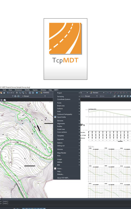
MDT is an application that is installed as a plugin on AutoCAD, BricsCAD, GstarCAD or ZWCAD. It offers a powerful set of tools for easy learning and has a modular structure.
It allows you to model a terrain using points measured by any total station or GNSS receiver, importing files or connecting to web services. It provides options for generation of contour lines, drawing of profiles and cross-sections, calculation of volumes, visualization of terrain in 3D, slope maps, import and export GIS files, etc. It also has functions for working with plots and multiple additional utilities.
By using our website, you agree to our use of cookies. If you want to know more, press the Privacy Policy button.