© 2026 Haldera Trading Ltd., All Rights Reserved
Καλλιπόλεως 3, Γρ. 403, 1055 Λευκωσία
ΤΗΛ: +357 22678897, email: office@haldera.com.cy
Καλλιπόλεως 3, Γρ. 403, 1055 Λευκωσία
ΤΗΛ: +357 22678897, email: office@haldera.com.cy

")

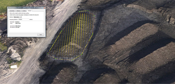
UAV Data Processing and 3D Reality Modeling
Create 3D reality meshes, point clouds, DEMS and orthophotos for projects of any scale using photographs taken with the Sirius or Falcon 8 UAVs. Once created, access and share richly phototextured models. The ContextCapture Advanced integration includes CAD, GIS, civil engineering, and survey workflows, with deliverables in in multiple formats.
Features:
By using our website, you agree to our use of cookies. If you want to know more, press the Privacy Policy button.