© 2026 Haldera Trading Ltd., All Rights Reserved
Καλλιπόλεως 3, Γρ. 403, 1055 Λευκωσία
ΤΗΛ: +357 22678897, email: office@haldera.com.cy
Καλλιπόλεως 3, Γρ. 403, 1055 Λευκωσία
ΤΗΛ: +357 22678897, email: office@haldera.com.cy

")

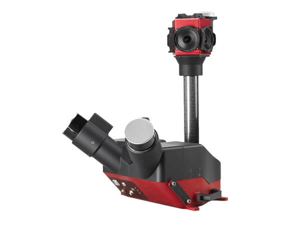
Designed to be operated in the field by a single operator, Scanfly DUO is the ideal tool for digitizing metropolitan areas and infrastructure assets. With the help of the SLAM algorithm and the twin multi-channel Lidar heads, the environment can be precisely modelled with reduced shadows and increased accuracy in GNSS-diminished areas.
Start digitalize your roads today with Scanfly DUO!
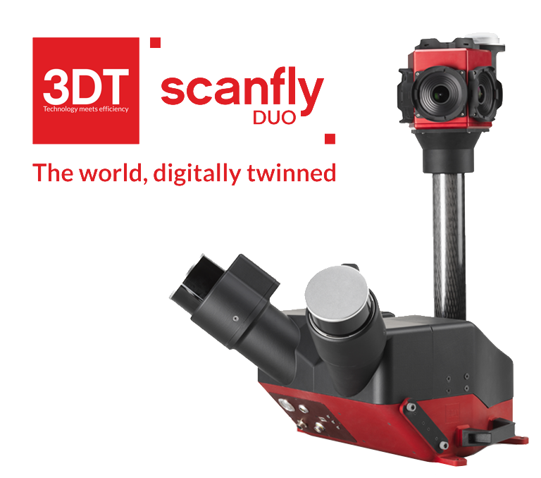

■ Survey grade Applanix AP+30 (IMU/GNSS)
■ Multi-constellation RTK GNSS receiver
■ Powered by SmartProcessing Lidar
■ SLAM enabled
■ Carry case
■ Dedicated rooftop mount. Easy installation in any land vehicle
■ High resolution panoramic camera
■ Ground control points and strip alignment tool
■ CE Marking. Ingress Protection IP55

| Code | 3DT-SF-v3-DUO+-30-7 [3], 3DT-SF-v3-DUO-30-5 [1], 3DT-SF-v3-DUO-30-6 [2] |
|---|---|
| Lidar Head | 2x CHCNAV LC10V2 [3], 2x Hesai PandarXT-32 [1] [2] |
| Weight | 16 Kg [1], 18.2 Kg [2], 22 kg [3] |
| Dimensions | 524 x 524 x 588 mm [1], 524 x 553 x 621 mm [2], 550 x 590 x 621 mm [3] |
| Ingress Protection | IP 65 (CE) [1] [2], IP 64 (CE) [3] |
| Scan Rate | Up to 2 560 000 pts/sec [1] [2], Up to 4 000 000 pts/sec [3] |
| Range | From 0.05m to 130m [1] [2], From 1.5m to 1.500m [3] |
| Point Cloud Accuracy | 2 cm |
| Precision | 2 cm |
| Camera | 30 MP FLIR Ladybug5+ [1], 48 MP CHCNAV C4800 [3], 72 MP FLIR Ladybug6 [2] |
| Storage | Removable (2 TB) |
| Connection | Ethernet, Wi-Fi |
| Software | SmartProcessing Lidar, SmartSurvey |
By using our website, you agree to our use of cookies. If you want to know more, press the Privacy Policy button.