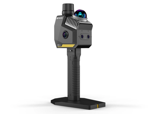
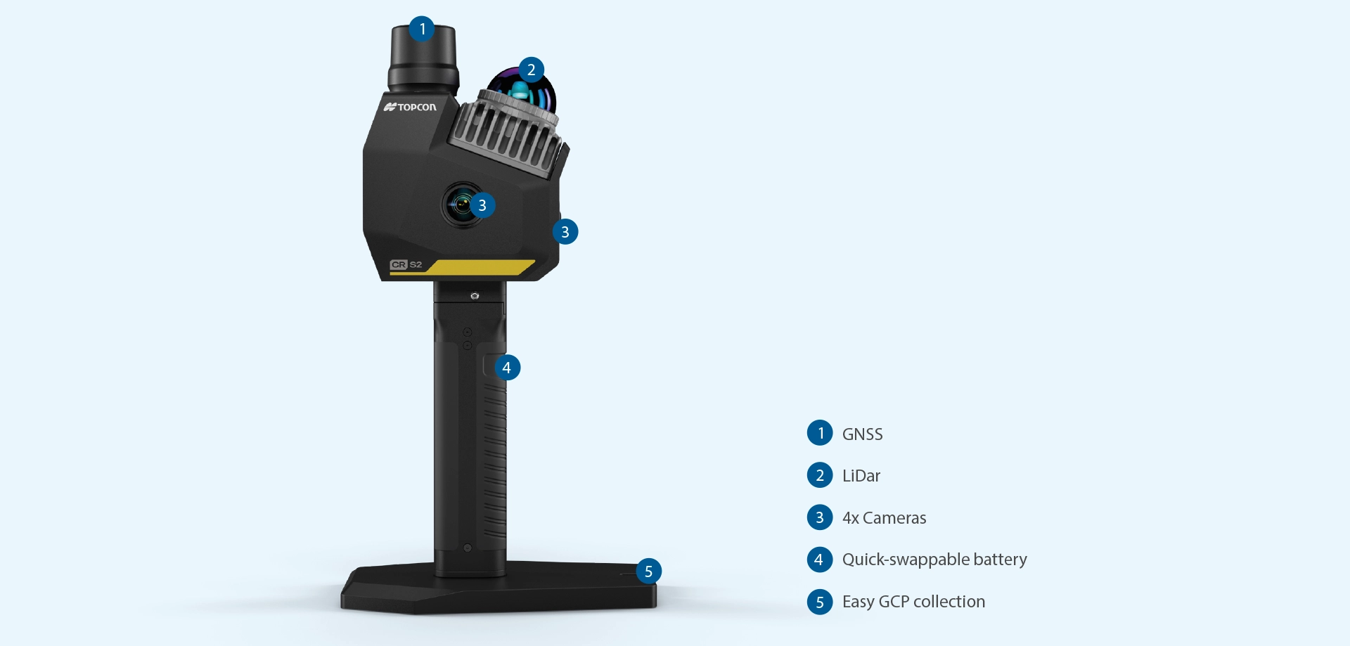
CR-S2

Hand-Held Scanner with VSLAM technology
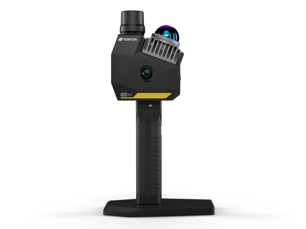
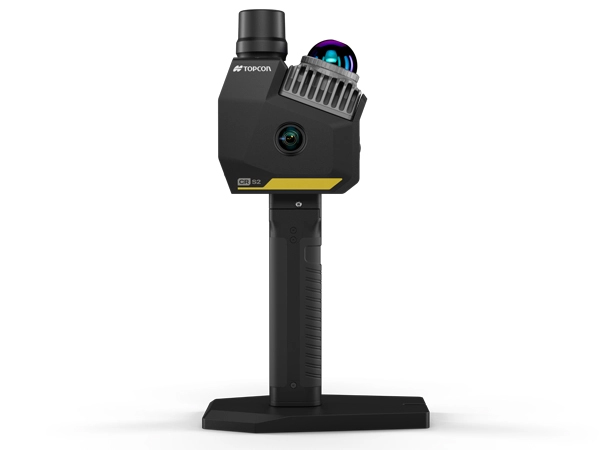
Description
Work faster and smarter with portable, high-performance 3D scanning.
Topcon CR-S2
Work faster and smarter with portable, high-performance 3D scanning.
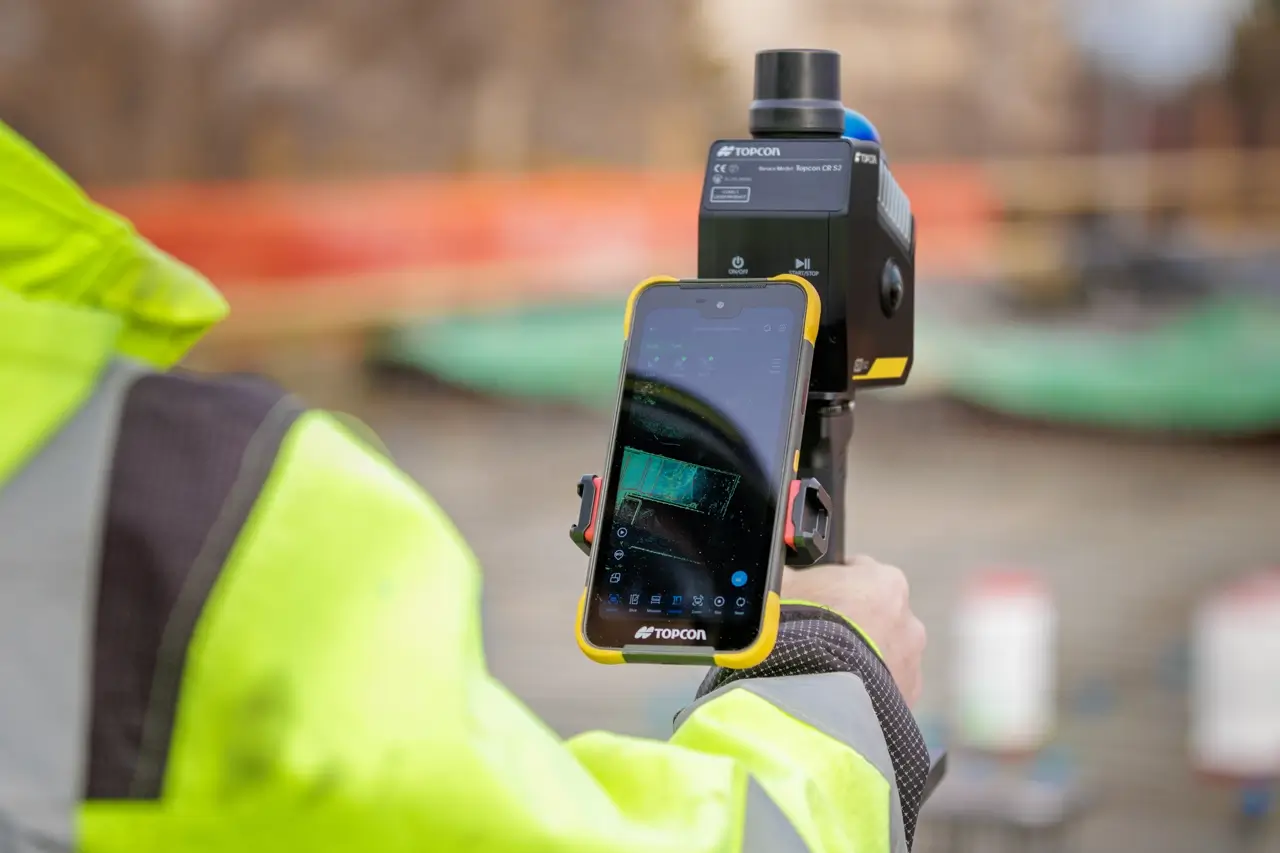
One-person operation and reliable data, anywhere you need.
How do you accelerate your reality capture projects?
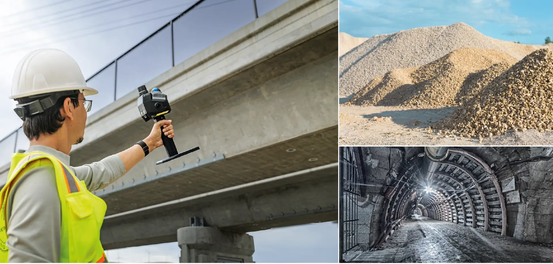
Professionals in construction surveying, geospatial, and engineering need reliable spatial data capture in challenging environments, including outdoor, indoor, and GNSS-restricted areas. Applications span site documentation, utility mapping, volume calculations, progress monitoring, and underground data capture, requiring efficiency and accurate data in complex, time-sensitive settings.
The Topcon CR-S series is designed to address these challenges through advanced multi-sensor fusion, integrating LiDAR-based SLAM, visual SLAM, inertial measurements, and GNSS positioning enhanced with RTK corrections. This combined approach delivers stable and repeatable positioning performance, supporting reliable results across outdoor, indoor, and GNSS-challenged environments, including dense construction sites, tunnels and mining environments.
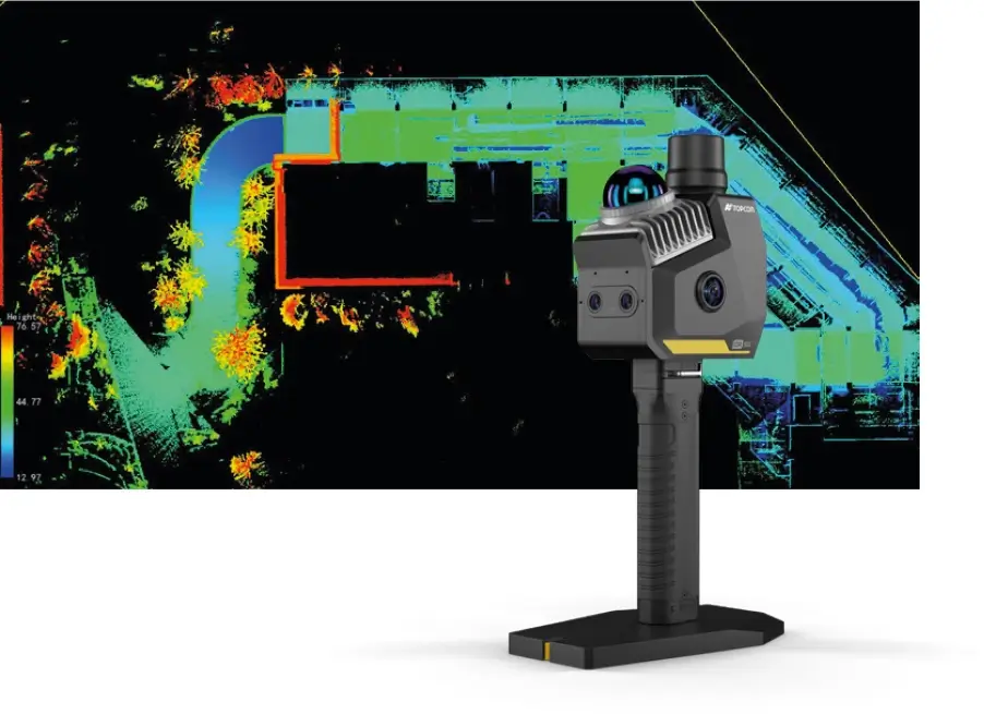
Capture with Confidence. Deliver with Precision
CR-S combines portable, one-person data capture with real-time point cloud preview, giving immediate confidence in coverage on site. Post-processing produces accurate 3D point clouds and orthophotos, supporting applications from volume measurement to comprehensive 3D site documentation.
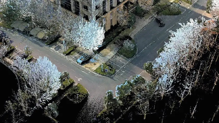
Seamless Workflow, Precise Results
Unlike conventional solutions that rely on multiple devices or fragmented steps, the CR-S series supports a streamlined, end-to-end workflow - from data capture to final deliverables. Powered by advanced sensor fusion and robust hardware, it helps teams work faster in the field while delivering consistent, survey-grade results project after project.
|
|
|
|
|
The CR-S2 is more than just a SLAM scanner.
These tools are built for the modern professional who demands both performance and practicality.